소프트쉐어-AI,무료소프트웨어,무료프로그램 공유마켓

본문 바로가기

팝업레이어 알림

팝업레이어 알림이 없습니다.
내 PC의 OS와 브라우저 정보입니다. ex icon
os 알 수 없음
browser 알 수 없음

AOS

지도/내비게이션

TomTom AmiGO - GPS Navigation

Install TomTom AmiGO at no cost and enjoy adfree navigation Your intelligent driving companion with EV navigation shows you charging stations EV charger info and the best ways around live traffic speed cameras and hazards Enjoy EV navigation and find detailed info on charging stations and EV chargers near you First create your vehicle profile for personalized EV navigation tailored to your specific vehicle and EV charger type Second choose the desireable battery charge levels at the destination and at the EV charging stations Next when you plan routes and search for EV charging stations AmiGO will filter EV charging stations that match your EV charger type and other requirements Get ready for a hasslefree drive Speed Camera Warnings know your average speed and drive within speed limits with fixed and mobile speed camera alerts Realtime Traffic Alerts avoid blocked and closed roads and get an update when the traffic jam ahead of you is slowmoving Easy Navigation pinpoint incidents on the map and navigate with clear guidance EV Navigation and Charging Stations plan routes tailored to your vehicle profile and find compatible EV charging stations on the map showing you EV charger availability EV charger connector type and EV charger speed Charging stations views see the availability of the charging stations directly on the map or in the list Android Auto follow navigation from your cars display on a larger screen Trusted Arrival Times get proprietary maps coming from 30 years of experience to give you the most accurate traffic information Adfree focus on the road no interruptions Privacyfocused your data is always protected we will never sell your data or serve ads Beautiful Interface enjoy visual guidance of the maps and instructions to all your destinations Drive to your Calendars amp Contacts search for the addresses stored on your phone straight through AmiGO Report Incidents share radar jam hazards and more traffic updates with other drivers Auto start/stop via Bluetooth connection get alerts and instructions through your car speakers with the handsfree protocol Overlay Mode see speed camera and traffic updates with AmiGOs widget even when you dont need navigation Simple Lane Guidance follow easy instructions and the route bar for turnbyturn navigation Join the millions of drivers enjoying adfree navigation with TomTom AmiGO The use of this app is governed by the Terms and Conditions at tomtomcom/enus/legal/ Additional laws regulations and local restrictions may apply You use this app at your own risk The Speed Camera Services must only be used in accordance with the laws and regulations of the country where you are driving This functionality is specifically prohibited in some countries/jurisdictions It is your responsibility to comply with such laws before driving and activating the services You can enable and disable Speed Camera warnings on AmiGO Learn more at https//wwwtomtomcom/navigation/mobileapps/amigo/disclaimer/ EV navigation leverages intricately designed profiles for electric vehicles currently in an experimental beta phase As a result estimations of energy consumption en route recommendations for EV charging stations and the overall EV navigation experience may exhibit variability in reliability under certain conditions
  • 평점
  • 평점 0
  • 무료

2

자세히보기

AOS

지도/내비게이션

UTM Geo Map

토지 측량 지형 수심 측정 및 GIS에 대한 완전하고 간단하며 사용하기 쉬운 무료 응용 프로그램입니다 측지 공학 토목 공학 지질학 및지도 좌표 위치 주소 및 공간 분석과 관련된 기타 분야에 적합합니다 위치 좌표 위치 및 주소 면적 및 거리 측정 Overlay Buffering TIN / Delaunay Triangulation Voronoi Diagram Convex Hull Smoothing Show WMS Map Map Server과 같은 간단한 공간 분석 도구로 사용할 수 있습니다 기타 지도 좌표 위도 경도 UTM MGRS WGS84 및 기타 CRS EPSG 코드 사용를 실시간으로 획득하는 데 사용할 수 있으며 좌표 데이터 소요 시간 메모 / 라벨 고도 프리미엄 주소 사진 등이 모듈은 기존 포인트에서 실시간으로 TIN 보로 노이 다이어그램 및 버퍼를 표시 할 수도 있습니다 오프라인 GPS 오프라인 상태 인터넷 액세스없이에서 좌표를 가져 오는 데 사용됩니다 휴대 전화가 휴대용 GPS처럼 작동하여 위도 경도 좌표 UTM MGRS 고도 타원체 MSL 고도 EGM96 정확도 위성 및 기타 유용한 정보 좌표 데이터는 메모 / 라벨 사진이 주어지면 데이터베이스 내에 무제한으로 저장하거나 CSV KML DXF 및 GPX 형식으로 내보낼 수 있습니다 협정 변환기 위도 경도에서 UTM 및 MGRS로 또는 그 반대로 좌표를 수동으로 변환합니다 또한 주소를 좌표로 변환하는 데 사용할 수도 있습니다 지오 코딩 인터넷 연결 필요 일부 변환은 일괄 변환을 지원합니다 면적 / 거리 거리 및 면적 측정 지원 단위 m km ft 마일 헥타르 에이커 선 / 다각형 등록 측정 지점에서 자동으로 다각형 만들기 선에서 버퍼 생성 / 폴리곤 오버레이 등 라인 / 폴리곤 데이터는 데이터베이스 내부에 무제한 저장지도에 표시 사진 및 레이블 추가 또는 CSV KML 또는 DXF 형식으로 내보낼 수 있습니다 Snap Nearest Delete Object Inside / Outside Polygon Smoothing cubic bezier interpolation Split Polygon By Line 등과 같은 공간 편집 알고리즘을 갖추고 있습니다 CSV 및 KML 형식을 읽어 참조 파일로 가져 오거나 표시 할 수 있습니다 Marker Map Map Coordinates 모듈과 유사하지만 동적 / 가변 버퍼 표시와 같은 더 완전하고 복잡한 지오메트리 계산이 있습니다 이 모듈에서 TIN 및 Voronoi 다이어그램과 같은 기하학적 분석은 점 데이터 마커와 선과 다각형 브레이크 라인의 조합으로 만들 수 있습니다 이러한 형상은 다른 장치 또는 PC에서 사용하기 위해 KML 또는 DXF 파일로 내보낼 수도 있습니다 나침반지도 자기 편각이있는지도와 나침반이있는 모듈은 방위각을 탐색하거나 측정하고 거리 및 방향을 결정하는 데 사용할 수 있습니다 오버레이 Union Intersection Difference 및 SymDifference를 포함한 여러 옵션으로 오버레이 작업을 특별히 수행하는 데 사용됩니다 버퍼링 기존 포인트 라인 및 폴리곤 데이터에서 특별히 버퍼링 작업을 수행하는 데 사용됩니다 고도 프로필 미터법 및 피트 / 마일 단위로 고도 데이터에서 간단한 고도 프로필 단면 / 장단면을 생성하는 데 사용됩니다 이 모듈은 경로 프리미엄의 고도 프로파일을 포함하여 여러 지점에서 고도 프로파일을 생성 할 수도 있습니다 등고선 등고선 수 원하는 고도 또는 등고선 간격을 기반으로 등고선을 생성하는 모듈입니다 이것은 프리미엄 모듈이며 인터넷 연결이 필요합니다 DTM 디지털 지형 모델 임의 포인트 또는 기존 등고선에서 일반 DTM / DEM 그리드를 생성하기위한 그리드 보간 모듈에 무작위 다른 모듈 웹 사이트 https//wwwutmgeomapcom 빠른 가이드 pdf https//wwwutmgeomapcom/utmgeomapquickstartpdf 유튜브 https//wwwyoutubecom/channel/UCspxQ5nQiqRD88g6GcCqw 어떤 제안이라도 환영합니다 이메일을 통해 utmgeomapappgmailcom으로 제출하거나 리뷰를 작성하십시오 감사
  • 평점
  • 평점 4.4
  • 무료

2

자세히보기

AOS

지도/내비게이션

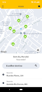
PassApp - Transport & Delivery

PassApp is the biggest ride hailing in Cambodia You can book fast taxi in Phnom Penh Siem Reap Battambang Sihanoukville Kampot Poipet City We support transfers to the airport Our services With our app a cab tuktuk rickshaw with taximeter can be booked wherever we go to or from the airport running late for work or getting home late at night You are guaranteed to get there safely and always in time Our operational areas PassApp provides taxi services in the biggest cities in Cambodia Phnom Penh Siem Reap Battambang Sihanoukville Kampot Poipet Kampong Cham City Good prices We offer transport in only at affordable prices PassApp cooperates with professional local drivers to keep up to the highest industry standards That is what makes us to be a leading cab service in Cambodia Pass App is available 24/7 Our cab drivers use modern precise meter Using the app you can book TukTuk Rickshaw Cab SUV Book taxi easily To order PassApp service you need active mobile phone number only When your account is ready you need to set pick up and choose service type After you have made a booking the app will prompt you when taxi driver arrives After the payment is processed in full the bill will be sent automatically to your inbox Technology We go hand in hand with technology Thats why PassApp Cambodia employs stateoftheart software to improve your lifestyle Our 24/7 app allows to grab a rickshaw ride anywhere fast and easily Follow us passapptaxiscom/ Email passapptaxisgmailcom Hotline 016789123 Facebook facebookcom/PassApp/
  • 평점
  • 평점 3.7
  • 무료

2

자세히보기

AOS

지도/내비게이션

Zeo 경로 플래너 - 다중 경유지 경로 최적화

시간과 절약 더 빨리 집으로 돌아 가기 Zeo Route Planner는 가장 짧고 빠른 경로를 제공합니다 매일 한 시간 이상을 절약하고 집에 더 빨리 도착하십시오 운전자는 도로에서 보내는 시간을 30 이상 절약하고 연료비를 20 절약합니다 그것은 당신의 주머니에 더 많은 돈을 의미합니다 무제한 경로 약정 사용 없음 생성 또는 최적화 된 경로 수에 제한 없음 첫 번째 경로를 만드는 데 로그인 신용 카드 정보가 필요하지 않습니다 배송 또는 픽업 경로를 시작하고 종료 할 위치를 Zeo Route Planner에 알리고 경유지를 추가하면됩니다 최적화를 클릭하면 마법을 사용할 수 있습니다 음성 지원 입력 Excel 업로드 및 이미지 검색 모든 악센트에 액세스 할 수있는 주소를 추가하기위한 음성 지원 입력 Excel 스프레드 시트 또는 CSV를 통해 매니페스트 가져 오기 매니페스트에서 이미지를 스캔합니다 팀 계획에서 shopify 및 Woo Commerce와 주문 통합 거리 시간 정지 주행 거리 급격한 브레이크 및 운전자 성능 등 여정에 대한 보고서를받습니다 정지 한 순서 이동 한 총 거리 및 소요 된 총 시간을 알고 싶으십니까 기관 또는 고용주에 제출할 포스트 라우트 매니페스트를 다운로드하십시오 배송 또는 픽업 경로를 시작하고 종료 할 위치를 Zeo Route Planner에 알리고 경유지를 추가하면됩니다 최적화를 클릭하면 마법을 사용할 수 있습니다 상세 정보 및 고객 확인 중지 모든 정류장 시간 슬롯 또는 ASAP 배송에 대한 특별 지침을 추가하십시오 경유지 유형 지정배달 또는 픽업 설명을 통해 중지에 대한 특별 지침을 지정하십시오 사진 또는 서명을 통해 고객 확인 받기 고객이 실시간으로 추적 할 수 있도록 ETA를 고객과 공유합니다 Zeo Route Planner 멀티 스톱 배송 경로 플래너는 예상 도착 시간을 제공하며 이러한 도착 시간은 배송시 자동으로 업데이트됩니다 일정보다 늦거나 빠르더라도 도착 시간은 항상 최신 상태로 유지됩니다 도중에 정차하는 동안 교통량을 고려합니다 원하는 방식으로 탐색 Google Maps Apple Maps Waze Tom Tom Maps Here we go Maps 또는 당신이 편한 다른 탐색 옵션을 사용하세요 최적화 된 경로를 탐색하여 시간을 절약하세요 우회로를 만들려면 최단 경로를 다시 라우팅하십시오 왕복을 위해 시계 반대 방향으로 이동합니다 경로 중에 정류장을 쉽게 추가하거나 삭제할 수 있습니다 그리고 더 많은 옵션 무제한 배송 경로동적 경로 변경 이동 중에 중지 추가 및 삭제 Google지도 및 Waze와 같은 좋아하는 내비게이션 도구로 탐색 배달 시간 설정 통행료 및 고속도로를 피하십시오 음성 지원 위치 입력 엑셀 업로드를 통해 배송 위치 가져 오기 시간 슬롯 기반 배송 최대한 빨리 배달 우선 순위 지정 woocommerce 및 shopify와의 통합 마일 및 마일리지 기록 현금 비용
  • 평점
  • 평점 4.8
  • 무료

2

자세히보기

AOS

지도/내비게이션

Saphe Link

Saphe Link is the official app for your Saphe traffic alarm Avoid accidents and speeding fines A traffic alarm from Saphe not only helps you avoid speeding tickets but increases your safety and reduces the time you spend in traffic Saphe traffic alarm With a traffic alarm from Saphe you gain a wealth of benefits Accurate alerts about speed cameras accidents and dangers on the road Starts up automatically with your car Quick and secure operation You become part of a traffic community of more than 11 million users Works abroad where you gain access to approx 100000 fixed speed cameras Saphe Premium subscription Saphe Premium gives you access to additional features Speed limit display Speeding assistant Route navigation Android Auto and Apple CarPlay At the same time your subscription ensures that you will continue to receive the latest updates and features The new Saphe Drive Pro traffic alert requires a paid subscription to Saphe Premium Saphe Premium can also be combined with older models such as Saphe One and Saphe Drive Mini Getting started Download the Saphe Link app Create a user account Connect the traffic alarm to your smartphone via Bluetooth Activate/create a subscription for Saphe Premium required for Pro If you have a starter pack the traffic alarm is already set up with a 12month subscription Place the traffic alarm in the car within sight and reach Please note that to be able to start automatically Saphe Link needs access to your location while the app is in the background continuous use of GPS in the background may drain your battery faster than normal One of Europes largest traffic communities As a Saphe user you become part of a community with data from over 11 million road users across Europe helping each other to save lives time and money Saphe gets traffic data from partners all over Europe and the community is growing all the time Saphe has data partners in Germany Finland Spain the Netherlands and Belgium Customise Saphe Link to your needs Select the alerts that are important to you When you have ensured that you only receive the alerts that are applicable to you you will be able to set alert times alert information and tone etc Lightning fast communication Saphe Link enables motorists to communicate with each other quickly and efficiently by sharing data about everything that happens on the road This form of communication can make a significant difference with the goal of reducing the number of accidents in traffic If an incident occurs on your route that you need to pay attention to you will be informed quickly thanks to the active community of motorists You can also help them by reporting traffic incidents yourself The traffic data is updated in real time to ensure a high quality of the latest warnings Find out more about Saphe at wwwsaphecom Best regards Team Saphe
  • 평점
  • 평점 0
  • 무료

541,875

자세히보기

AOS

지도/내비게이션

2

자세히보기

회원로그인

회원가입

브랜드 소프트쉐어

대표 김동영

사업자번호 428-81-02729

통신판매업신고번호 2023-부산해운대-0096호

개인정보책임자 김동영

주소 : 부산광역시 해운대구 센텀중앙로 78, 센텀그린타워 504호