


 다운로드 TOP50
 PC 카테고리
 자유게시판
자유게시판
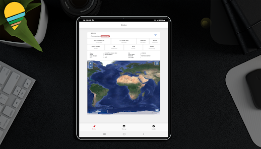
GIS Survey Mobile
 다운로드수 57
-
0 (0명)


| 분류 | 생산성 |
|---|---|
| 버전 | 2.1.1 |
| 연령 | 3세 이상 |
| 업데이트 | 2023. 1. 3. |
| 금주 다운수 | 0 |
| 누적 다운수 | 57 |
| 개발사 | PT Techno GIS Indonesia |
| 다운로드 | |
|
!소프트웨어 사용범위 위반 시
법적 책임을 질 수 있습니다. |
|


상세정보
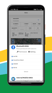
GIS Survey Mobile is an application designed to make it easier for surveyors to perform more efficient topography measurements
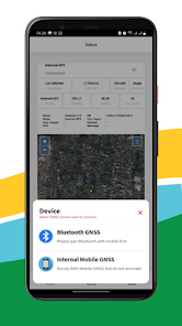
GIS Survey Mobile is intended for retrieving Geodetic GNSS Coordinate data from the Equator GNSS Product recommendation but if you don39t have an Equator GNSS Unit you can also use it from the Smartphone Internal GPS integration but the accuracy is not as good as using the Equator Geodetic GNSS
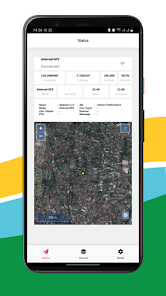
With GIS Survey Mobile surveyors can determine project activities through simpler command features such as those used for Static measurements RTK Radio NTRIP PPK Mode and from GIS Survey Mobile later output data in the form of points lines and areas
Exporting results from data retrieval using GIS Survey Mobile is easier and more convenient with the stored data having a choice of the required data formats such as TXT CSV GEOJSON Apart from that it is also supported by importing Geojson data which can be used for reference points or work areas that have been planned
Simple application usage
Free download from Google Play Store
compatible with android devices
Support all survey modes including Static PPK RTK dan NTRIP
Support to serve various survey tasks seperti Surface Stake Mapping Survey and etc
Access to realtime open street maps
Support Geojson import and directly use for stake out operations
리뷰
- 소프트쉐어 신규 소프트웨어 추가 안내 2025.01.17
- 소프트쉐어 서비스 이용 가이드 업데이트 안내 2025.01.17
- 소프트쉐어 웹사이트 리뉴얼 안내 2025.01.17


