


 다운로드 TOP50
 PC 카테고리
 자유게시판
자유게시판
Land
 다운로드수 52
-
0 (0명)
| 분류 | 내비게이션 |
|---|---|
| 버전 | 버전 2.2 |
| 업데이트 | 2019년 4월 8일 |
| 용량 | 38MB |
| 앱결제 | ₩4,400 |
| OS | iPhone: iOS 9.0 이상 필요 / iPad: iPadOS 9.0 이상 필요 / i |
| 디자인 | iPad용으로 디자인됨 |
| 금주 다운수 | 0 |
| 누적 다운수 | 52 |
| 다운로드 | |
|
!소프트웨어 사용범위 위반 시
법적 책임을 질 수 있습니다. |
|


상세정보
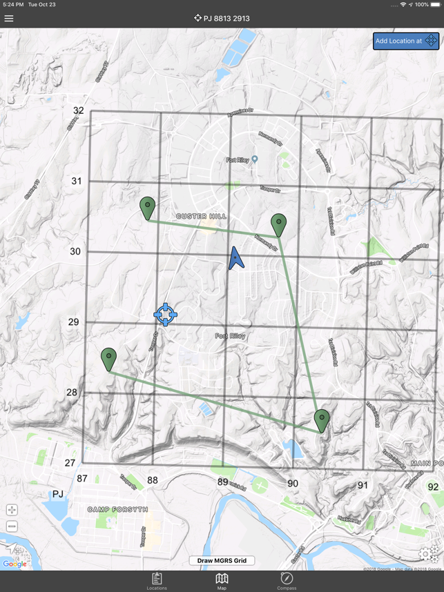
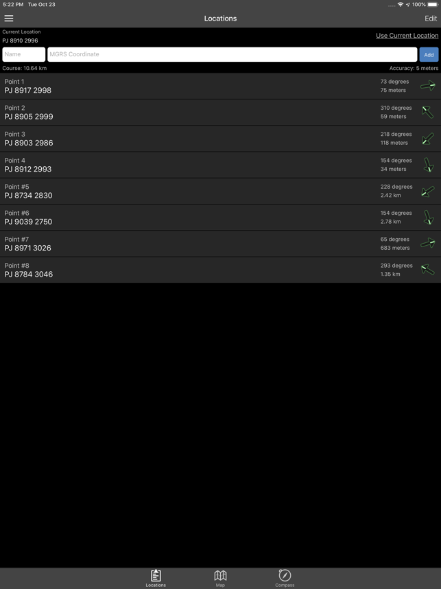
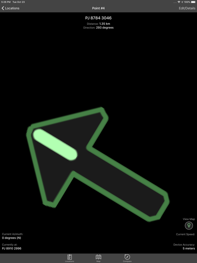
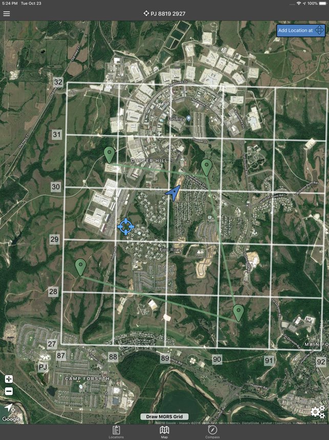
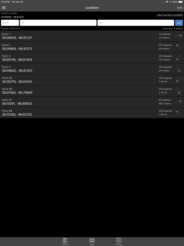
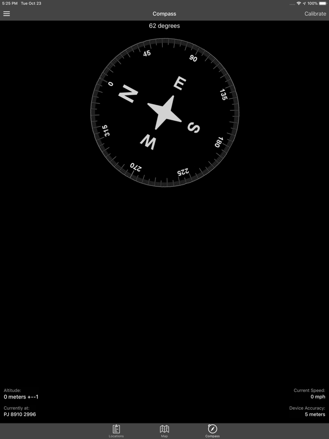
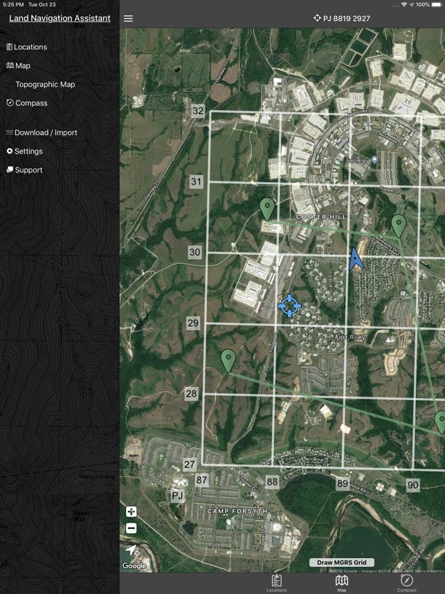
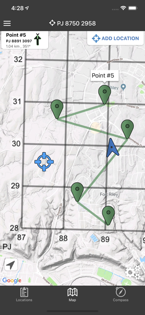
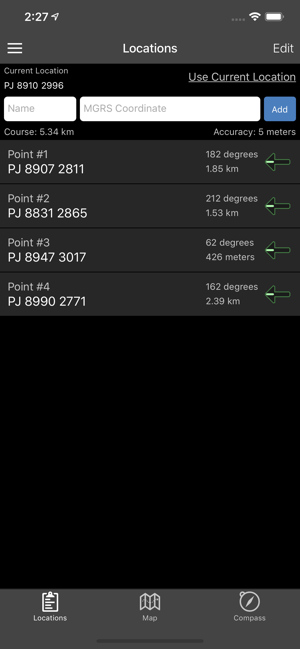
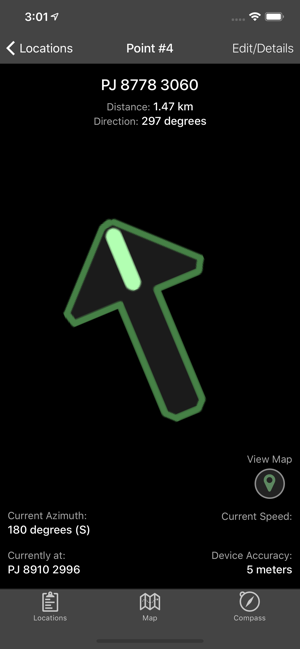
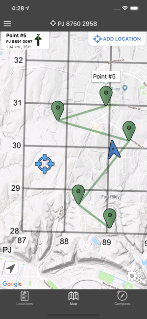
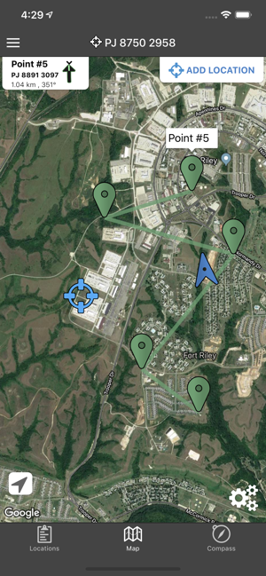
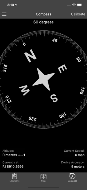
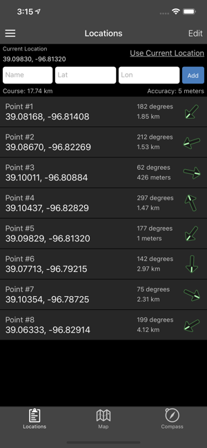
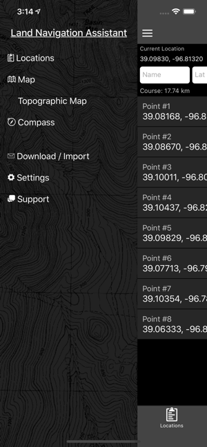
Land Nav Assistant accepts MGRS (Military Grid) or Latitude / Longitude coordinates and visually navigates you to each point.This app was designed with Army, Marine, and other military personnel in mind. Use it to correct your Land Nav technique by analyzing your pace count and tendency to veer left and right.Available Input: 8 digit MGRS, 10 digit MGRS, Lat/Lon decimal, Lat/Lon dms, and map input.Angles: degrees or milsDistance: meters/km or feet/milesSpeed: kph or mphUse the simple arrow interface or map to direct you to your locations. Your distance, direction, speed, and bearing are shown as you navigate.Long-tap anywhere on the map to get the coordinate for that location. Easily add locations via the Map interface.Plan your course by ordering points, or use the course optimization tool which will help you calculate the shortest path possible!Get distance/direction between two points by tapping the path drawn between them.Satellite, Terrain, Road, and basic Topographic maps show yo
새로운 기능
Draw MGRS Grid Overlays anywhere on the map (1000m, 100m)iOS 12 OptimizationScreen improvements for iPhone X, XS, and XR
저작권
© Gammon Applications
리뷰
- 소프트쉐어 신규 소프트웨어 추가 안내 2025.01.17
- 소프트쉐어 서비스 이용 가이드 업데이트 안내 2025.01.17
- 소프트쉐어 웹사이트 리뉴얼 안내 2025.01.17


